An easy to use web application to store view process analyze
drone data and laser scans.
An easy to use web application to store, view, process and analyze drone data and laser scans
Nexplore Earthworks
Viewing and analyzing drone data and laser scans of construction sites typically requires specialized desktop software and expert knowledge on how to use it. Hence, the contained information is only available to selected individuals while other team members cannot benefit from it or have to wait for an expert to provide the desired insights. With Nexplore Earthworks valuable insights are now accessible to everybody!
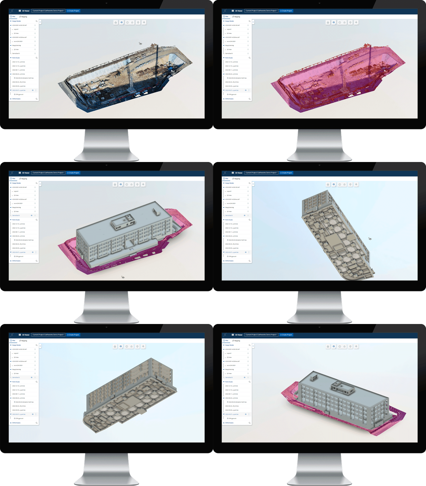
It happens on construction sites just like anywhere else – sometimes you do not to see the forest for the trees. Good, if you can then have a change in perspective. Point clouds captured on site provide a virtual representation of the real world that can be superimposed by 3D models to check progress and conformity.
Project Managers can make use of reality capture data from drones and laser scanners to view, analyze, and document the status of the construction process at a certain point in time.
Surveyors view and analyze the terrain or calculate stockpile volumes and cut to fill from point cloud data without having to go out and perform time-consuming measurements on sites – all of which helps the construction team to arrive at a comprehensive overview of the full construction site from a bird’s-eye perspective to check progress or locate material and machinery.
By monitoring earthworks and keeping track of material movement teams can optimize material flow and reduce waste.
Ultimately, visualizing a situation in an accurate 3D representation allows for communicating a lot more effectively on inherent quality issues or potential risks.

Features
1.
Gain better situational awareness: View drone data and laser scans to remote inspect and overview the construction site.
2.
Check conformity with the design: View 2D/3D design models (more than 60 file types supported) and overlay with point cloud data captured on site for as-is/as-planned comparison.
3.
Monitor earthworks: Determine stockpile volumes and cut to fill statistics.
4.
Improve communication: Mark and annotate points of interest in the scene and notify other users about your findings.
Benefits
Transparent: Drone data, laser scans and designs are accessible by all team members, not only experts.
Sustainable: Monitor earthworks to improve material flow and reduce material waste.
Resource-saving: Avoid time delays and penalties by identifying deviations from the design and/or schedule.
Connective: 2D/3D visualization of circumstances and issues on site facilitates communication.
Want to learn more?
Book a demo with us to learn more about your new favorite product.

